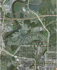
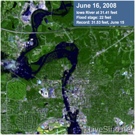
Virtual Earth 再一次更新了大量数据(超过 20TB最新照片数据),这次更新包括非汛期时的爱荷华 UltraCam 图片(左图),来自 Des Moines Register 的一张较近期的爱荷华的图片(右图):
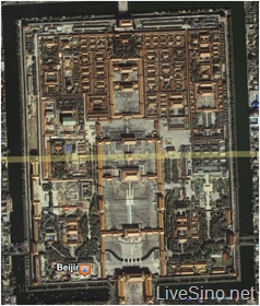
还有很多非 Ultra-Cam 图片,其中包括法国的很多地区,苏格兰和威尔士的一些地区,以及北京 😀 :
以及一个新的项目“GoVE”的启动:
此次启动的新项目“GoVE”,能够让所有自治市、州和当地政府等,能够通过这一平台一起分享各地的照片上传至 Virtual Earth,而这一举动不是只有 Live Search Maps 受益,因为 Virtual Earth 的数据同时还供给给其他一些相当多的企业、应用平台。
GoVE supports the data sharing goals of many public sector organizations by providing a free publishing service. Through GoVE, your taxpayer-funded information will be provided on a free, open access web site that benefits taxpayers, government officials, your corporate tax base, state and local governments, etc.
Things like tourism, transportation, utilities, energy, emergency preparedness, natural resources management, and economic development can be assisted through the broad scale distribution of public data.
更多内容请参考:Virtual Earth Imagery Release – June, 2008;Publish Your Aerial Photography to Virtual Earth
LiveSide:Don’t like the 20TB of new data in Virtual Earth? Submit your own!

发表评论