 之前我也提到过,PhotoSynth 中的定位功能采用了 Virtual Earth 平台。今天,我就根据 Chris Pendleton 的最新文章来介绍一下另外一种 PhotoSynth 与 Virtual Earth 的混合应用,其中使用到了 Virtual Earth SDK。
该应用就是将 PhotoSynth 嵌入至 Virtual Earth 中,代码、范例可以点击这里查看:
首先,创建自己的 PhotoSynth:PhotoSynth 体验中有介绍。
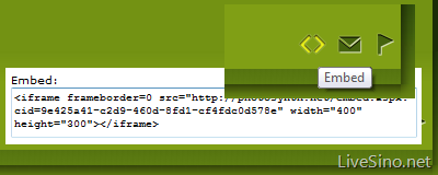
然后,获得 PhotoSynth 的嵌入代码,以及在 Virtual Earth 中需要的经纬度(经纬度获取方法可以参考 Windows Live 互动 SDK 文章末尾):
最后,复制 https://livesino.net/dev/VirtualEarth/PhotoSynth_VE.html 范例的 html 源代码,并做以下修改:
- <!–List of Synths to insert into ERO Description—> 之后的 synth1、synth2 等的值为自己的 PhotoSynth 嵌入代码。
- <!–Lat Longs for each Pushpin—> 之后的 propertypoint1、propertypoint2 为经纬度,对应输入。
- <!–Call back adds pins to the map—> 之后的,propertypin1.SetTitle、propertypin2.SetTitle 为标题,对应输入。
这是一款非常基础的 PhotoSynth 与 Virtual Earth 的混合应用,更多内容可以在 Virtual Earth SDK 中挖掘。相信自 PhotoSynth 团队加入 Virtual Earth 之后,PhotoSynth 和 Virtual Earth 之间的应用会越来越多。 😛
参考链接:Photosynth Released – Now, Let’s Mash it with Virtual Earth


评论当前被关闭。