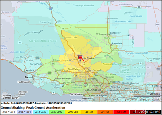
Chris Pendleton 在其博客上介绍了 ESRI 会议中出现的 Inlet (Internet-based Loss Estimation Tool) 损失评估工具,Inlet 是基于 Virtual Earth 的在线损失评估工具,交通模型平台(检验解决方案是否确实能减缓灾害对交通系统的影响)。
INLET currently incorporates GIS, a risk model, and a transportation model to provide online estimates for building damage, transportation impacts, and casualties. Additional features include a demonstration of a model simulating the effect of IT on evacuation routing. Specifically, the model illustrates how awareness of a disaster scenario and familiarity with routing alternatives can impact traffic congestion and evacuation time.
但是该工具目前只限用于美国加利福尼亚 California 地区。
访问:Inlet (Internet-based Loss Estimation Tool)
来源链接:Virtual Earth-based Loss Estimation Tool


3 条评论
Flying
Chris为什么总是有这么多内容来?
2008 年 08 月 12 日 4:51 下午
Picturepan2
呃,他是 Evangelist 专门就是推广,然后他不是需要成功案例支持的嘛?懂?
2008 年 08 月 12 日 5:52 下午
Flying
哦,绛紫啊,怪不得额...大概懂了吧.. :D
2008 年 08 月 12 日 6:03 下午
评论当前被关闭。